Wednesday, June 29, 2011

Puttering about Pushaw

Basics: Gould’s Landing off Essex Street in Orono. Sufficient parking, two portapotties, picnic tables, ramp and a small beach. Visiting the southern islands is about a 4 mile route.

We’ve spent much of the week scraping, scrubbing and painting, and then Saturday we had to re-ditch our road. Between those aches and bruises from rescue practice we weren’t up for much but a gentle paddle on Pushaw.


Pushaw Lake, which may have been named for a French family living on its shores(Pouchaird), is roughly 7 miles long and one mile wide. It gets very busy on weekends. Gould’s Landing, with its tiny beach, one of the only free public beaches near Bangor, is especially crowded. But, with temps in the mid 60’s and rain due, on this Sunday morning most of the folks stayed home.

We headed out first for Moose Island, one of two islands which people land on regularly. Many of the other islands on the lakes have cottages and are private property. Pushaw Lake is lined with camps, tiny homes whose land is measured in square feet. (In Maine ‘camp’ refers to anything from a primitive shack in the woods to a small cozy house; ‘cottages’ refer to estates built down by the ocean.)

But on the Orono shore there is a long undeveloped stretch, and that was the backdrop for our paddle.

We poked around Moose and found visual beauty in plants near the shoreline, enhanced by aroma of cedar and maple trees.


Next it was off to paddle by Ram and Dollar. From there, out to Hardwood, the second island which people land on.
A thin line of trees marks a harbor on Hardwood

Then back by Dollar and over to Mouse. On Mouse three cormorants hung out high in a tree.

All in all it was a fairly pleasant trip. The one downside was some truly disgusting trash at the landing. Orono has improved Gould’s Landing quite a bit in recent years, adding tables, trash cans, portapotties and a nature trail. Knowing that mothers bring small children there, I felt compelled to pull out my latex gloves and clean up, but it was disheartening. Between the lazy pet owner, unconcerned adult and whoever used the Penobscot River as a dumping ground for their wood chipper, I’m ready for a full fledged "people who ruin it for others" rant.
Chips on the Penobscot: these have been bobbing back and forth with the tide for over a week.

Sunday, June 26, 2011

First Roll of the Season

There are times when it seems like a pretty stupid idea to put yourself upside down in the water with sixty pounds of boat overhead, like right before the first roll of the year. I wondered if my muscle memory would return, or if I would wind up bailing out. And thinking of that I looked down at my skirt. Sometimes we bring our best equipment to roll with, other times older, spare pfds and spray skirts. This time we had older equipment, the skirt is tighter than I like and tough to free from the Vaag’s coaming. I practiced freeing the skirt, grabbing the ring and pulling forward and up. It was as sticky as I remembered. As I refastened the skirt, I realized my roll is half mental; I had to believe it before I could do it. And I knew I could, I thought back to paddles in August, rolling every mile to cool down, back to first paddles of prior years, one in the Pocomoke river of Maryland; no mask – just celebrating water warm enough to roll in. I reminded myself this was my best rolling boat, my best paddle, and I had a mask and a nearby spotter. Over I went, and up I came, half way anyway, enough to get a breathe. That was very comforting, I really enjoy breathing, and as long as I’m convinced air will be getting to my lungs soon, I’m pretty happy. Upside down in the water I immediately moved to increase my odds, lengthening the paddle by shifting my right hand closer to the blade(this is a left hand roll), and taking a bit of time to really lie back on the deck, thinking shoulders to the air, knowing my head would follow. And with that attempt up I came! Yeah! An auspicious start! From there I went back to shore, and dug in the equipment bag a bit more, coming up with a looser skirt. Then back to the water, out for a paddle to warm up, leans and sculling practice, and more rolls, mostly left rolls and a few right, a some sloppy but most pretty good. And a few rolls with no skirt at all. No trick rolls, but those will come later.

And no cameras, so I'll make do with a video from 2008. I tried another rescue, cowboy scramble rescue. I’m not very good at that, the extra weight which provides ballast to rolling, does less well crawling across the deck. Eventually I succeeded, but only by deploying a paddle float.
Next, T-rescue (with Mark) and the classic paddle float rescue.

I made an attempt to swim the boat (as talked about by Wayne Horodowitch in the June Atlantic Coastal Kayaker magazine.) A side stroke should move me and the boat a short distance to safety. Not much luck with that. I felt I was doing a lot of flailing and breathing in water with air when I could get above the surface. Maybe next time.

I hope, now that the weather is warm, that everyone will try some experiments with their boats. One thing I think everyone should try is walking their boat out to about shoulder depth, tipping it so it fills with water and then trying to get in the boat without using their feet on the bottom of the pond for leverage. Some boats, like this Keowee, have so little floatation that they float below the surface of the water. That boat can never be pumped dry, it can never be self rescued.
That doesn’t mean it’s a bad boat, it sees use every summer, especially with guests who want a very stable boat. But it should be used accordingly, never more than swimming distance from shore. Other boats, like the Vaag, float higher, but tip readily when someone tries to climb back in. Better to know what your boat does before you get too far from shore.

Tuesday, June 14, 2011

Lessons Learned at Owls Head State Park


Basics:  Launch Owls Head State Park, free entry, sufficient parking, outhouse, long walk to launch.  Launch 9:30, finish noon, low 11:30.

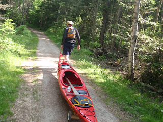
We planned to launch from the ramp on Mechanic Street in Rockland and paddle over to Owls Head Lighthouse, then return back through the harbor. We planned to do this on Thursday, the one day in this two week period that we were both commitment free. However as the date grew closer, predicted weather grew worse. It went from being the warmest day of the week to expecting severe thunderstorms and hail. So Thursday morning when the weather report shifted again, delaying severe weather until afternoon, we decided to head out. But we changed our plans from one long paddle to two short ones, a short paddle out from Owls Head State Park, where there is a cobble beach allowing hand carried launches and a second short paddle through Rockland Harbor. We’d see the highlights, plus launching from the state park would allow us to test Mark’s kayak carts.
We arrived in Owl’s Head just after 9AM, when the park opened. The fog which had muted our drive was lifting and a clear blue sky peeking through. We hopped out of our car and discovered that the beach that we’d imagined we’d launch from was not accessible. Instead we’d be launching off the backside.

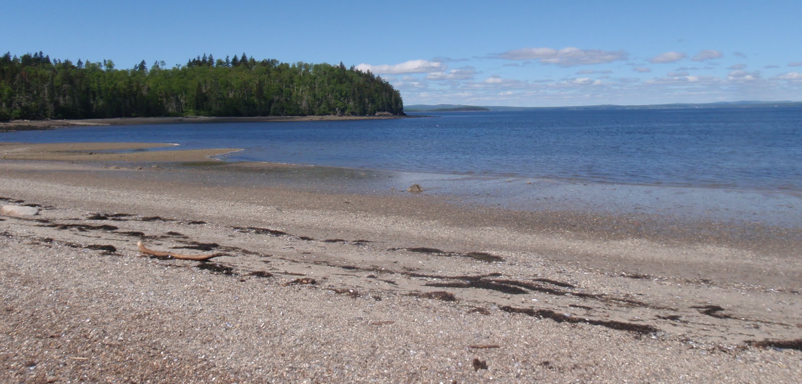
We headed down the trail to check out the beach, over 900 feet from the lot. The beach was a cobble beach, and with the outgoing tide it was apparent we’d need to wander through large seaweed and barnacle covered rocks to launch. Also, we picked up several hundred mosquitoes lingering in the calm of the beach who followed us back to the car and helped themselves as we loaded our boats and prepared for the drag down the hill.
Launching at the beach mid tide, seaweed and barnacles alreay exposed, I'm looking to see how many bugs I'll seal in with the skirt, and I'll take the net off shortly.
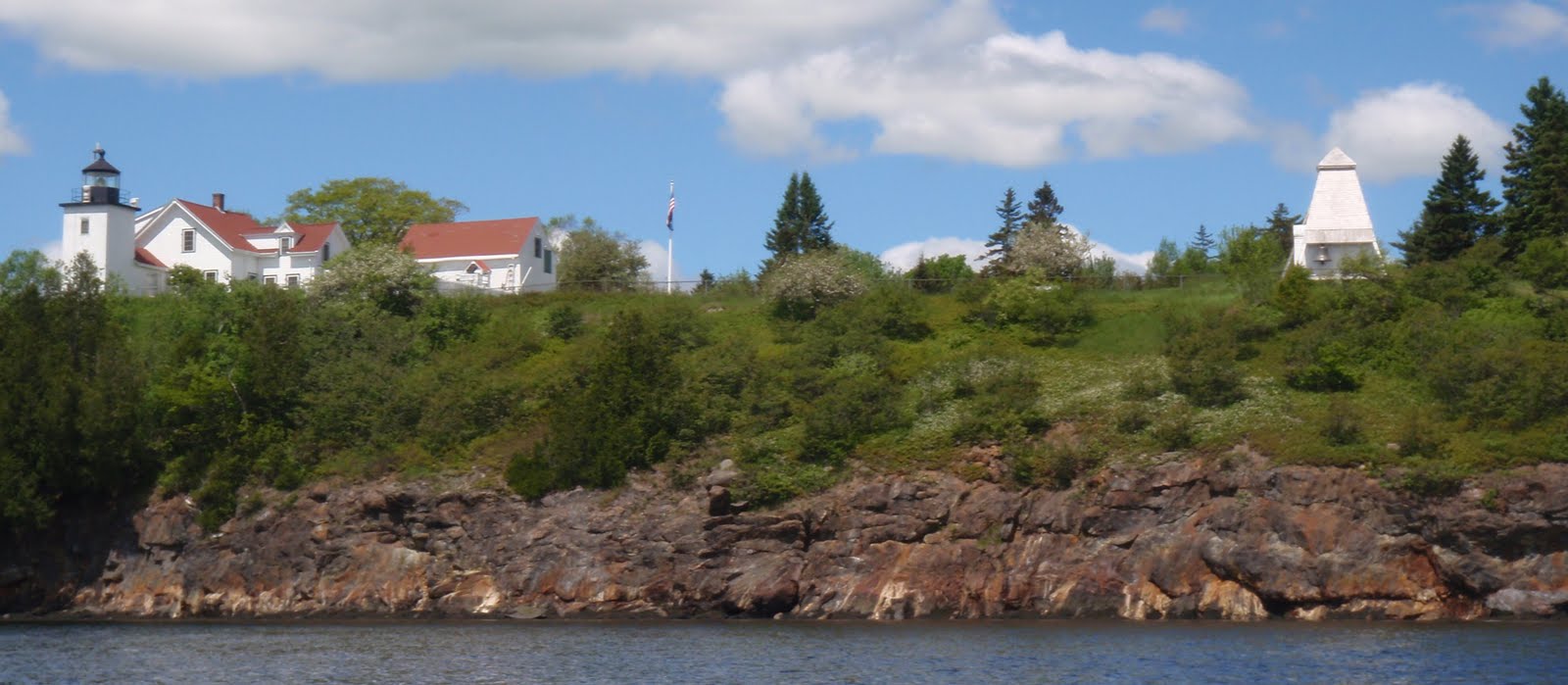
So you might not think we would be too fond of this launch, but it is an incredible site. Once on the water, the wind took care of our newly found buddies. In short order we were cruising by a lighthouse, and heading out to Monroe, a private island sprinkled with “Keep Off” signs. There we rode gentle ocean swells unimpeded since they’d passed Matinicus, while being cooled by a southeast breeze arriving over 50 degree water. Due south the islands of Muscle Ridge beckoned. Twice we’ve paddled to Muscle Ridge, both times the weather rapidly deteriorated and we struggled to get back against rising winds.


I love swell, but I have a great deal of trouble taking pictures in it. I have not mastered the one handed paddle brace that Mark uses and when if I’m focusing on the camera I don’t have feedback to help me balance my boat.

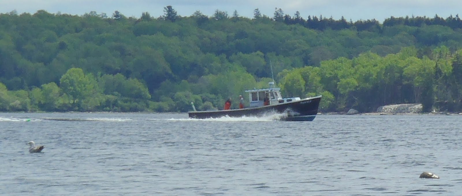
We were tempted to travel further south, but the chart we’d brought with us ended at Monroe, and perhaps because of our previous Muscle Ridge experiences we decided to stick with our initial plan. We headed to the shore and cruised through the calm waters of a private harbor used by several lobster boats.
And there in the middle of the harbor a guillemot (normally known as “a blurry black dots”) rested on a mooring.

Actually, there were quite a few birds about; laughing, herring and black backed gulls, eider, cormorants as well as osprey.

We headed back in to the beach, now filled with dozens of school children. They delightedly raced around the beach seeking treasures. My first thought was to remember how much fun I’d had when my fifth grade class walked to the beach for a memorable science lesson, and I could see these kids were having a similar experience. My second, and less honorable, was that we now had more targets for the mosquitoes.

The tide was lower, and there was no way to get to the beach without going through the barnacle and seaweed gauntlet. We got out of our boats in fairly deep water, attempting to save the hulls.

“Try not to flip,” Mark whispered to me. It’s no easy task to exit neatly into knee deep water, even using a paddle brace. I didn’t flip the boat, but on my first step I stumbled and wound up sliding my hand down a rock face. That pretty much sums up the process of carrying the kayaks to shore. My water shoes had a terrible time gripping, but though I had several missteps, I never actually fell on my face, which I count as a bonus. Though after crossing the beach, I looked down to see the bow of my boat splattered in red. That first slip had made several small cuts on my index finger, and the wet surface had kept the blood flowing.

There were no mosquitoes at the beach, I guess the army that had been there in the morning had retreated to shade as the sun grew stronger and the humidity dropped.
Another shot of the lighthouse
As we drove to Rockland for the second phase of the trip, the sky darkened, anvil headed clouds grew out of nothing and coalesced above us. Again our plans changed, rather than paddle in from the Mechanic Street launch we’d use the launch site in downtown Rockland.

It turns out Thursdays in downtown Rockland is a farmer’s market, with some amazing local soaps, and a portable brick bread oven as well as flowers and local produce. However, the sellers were filling much of the launch area parking. And it was far hotter than it had been out at Owl’s Head, mid 80's versus mid 60's. Worst of all, I couldn’t see the yellow buoy I’d admired so in the winter.

The fabled yellow buoy of Rockland as seen in December
We checked our chart, checked the water, and checked with some folkd wandering about the harbor. On our third try, we had success. A local sailor confirmed that there was a yellow buoy generally in the harbor, but it had just been recently removed.
Our arms exhausted from lugging the boats to and from the beach, looking at the crowded, hot still harbor, and with rain beginning to fall from those dark clouds overhead, we decided to call it a day.
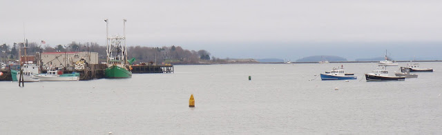
Some boats near the launch
Those clouds cleared up on the way home, there was no thunder until much later.

We learned a lot that day. It really is a long haul to the beach at Owls Head, even with a kayak cart. Mark’s carts worked pretty well, though their small size did mean more weight on our hands. The beach at Owls Head State Park is not ideal for launching, especially on a falling tide, but very quickly it places you in some amazing scenery and water. When we launch there again, I’ll bring my sturdiest water shoes, and a more extensive chart. And, sadly, yellow buoy’s are rarer than ever on the Maine coast.

Friday, June 10, 2011

A Kayak Cart

(Article by Mark) As time passes and I get older, the thought of carrying my kayak long distances to or from the water becomes less and less appealing. I have a commercial cart I use to haul kayaks up and down our hill, but it doesn't fit conveniently in a boat. My goal was to come up with a simple cart that would work well on fairly hard surfaces and that would fit into both the front and rear hatches of my boat. It had to be easy to take on and off, and preferably inexpensive.
Here's the result:


It's a set of 7" plastic lawnmower wheels attached to an axle (12" long section of 2x3") with a couple of ½ x 4" lag screws and some washers. Also attached to the axle, by deck screws, are a pair of support tubes (1 ½" PVC pipe cut to 3.5" long) that cradle the kayak and also provide a way to attach a strap to the cart. One of the support tubes has a gate slot cut into it to make it easier to pass the strap through. Total cost of this cart...about $15 (not including the strap).
Here it is mounted on my boat:

The cart is held onto the boat with the usual looped strap technique that you use to strap down a boat to a roof rack.
It's important that the forward part of the looped strap be prevented from slipping backward – I have caught the edge of my hatch cover on this boat. My wife's boat has recessed hatches so on that boat, I have to pass the forward part of the strap under the deck lines.
Here's a close-up of the support tube with the gate slot:
You don't have to put the gate slot in...a simple tube will work just fine. But you will have to thread the strap through it whenever you go to use it. With the gate slot, you can just pass the strap under – it saves time and frustration.
Here is the cart in both the front and rear hatches. This boat is a drop-skeg model and the skeg box takes up some room in the rear hatch. The cart was designed to fit into that tight area.

A final shot of the cart installed on the bottom of the boat, showing how the cart fits to the bottom of the boat with the round support tubes. My tubes are centered about 3.5" from the ends of the axle – I found that worked well with where I intended to mount the cart on our boats. Your boat may need different spacing – luckily, it's pretty easy to undo the deck screws and experiment with different configurations.

I've tried the cart out a couple of times now and been very pleased with it. After a bit of practice, I can install it in about 15 seconds on my boat. It takes longer on my wife's boat since I have to undo the strap loop in order to pass it under the deck lines – but I can still do it in less than a minute.
Since the cart is so narrow, it can go pretty much anywhere the kayak can, even down very skinny trails. If the forward strap is prevented from shifting back, the cart stays attached to the boat, even on rough ground.
I was concerned that the deck screws holding the support tubes onto the axle would let go but so far they have held up fine. If they look like they might fail, it would be pretty easy to replace them with small diameter bolts. If you intend to run the rig into the water a lot, you might want to spring for stainless steel or bronze for the metal parts and put some varnish on the wood.
Have fun carting! If you think of any improvements, please let me know.

Saturday, June 4, 2011

Paddle to the Sea Part 4: Fort Point to Wadsworth Cove, Castine Maine

Basics: Launch Wadsworth Cove, Castine, Sand Beach, Seasonal Portapottie.
Alternative Launch: Fort Point $2 entrance fee, long portage, Outhouses.
High 1:30PM Launch about 10:20 AM, Finish about 1:30PM 12 miles.

For the fourth leg of the paddle we opted to do a back and forth trip. The Penobscot Narrows bridge is the southernmost bridge on the Penobscot River so positioning cars for a one way journey between these two locations would mean a lot more driving than we cared to do. This trip is derived from Ray Wirth’s trip to Castine, and might more properly be called “Paddle from the Sea.” You see, winds were coming from the north, though they were projected to switch to south winds later in the day. Still, rather than being optimistic and starting at Fort Point and heading to Castine, we decided to start in Castine and head north, counting on a continuing north wind to overpower the effects of the incoming tide and aid us on our return journey.

We arrived at Wadsworth Cove at 9:50 AM, and it was still pretty chilly, just 55 degrees F. Wadsworth Cove is named for Henry Wadsworth Longfellow’s grandfather, General Peleg Wadsworth, who in 1781, after being captured by the English at Thomaston, Maine, escaped confinement in a cell at Fort George, and earned his freedom by wading across the cove.
The morning wind was steady and cooling (which we really didn’t need.) And, honestly this stretch of water looked to be pretty bland. But we’d set an arbitrary goal, so there was no looking back. We loaded our kayaks and headed resolutely north, aiming first for a classic estate set on the Cove.
As we came out of Wadsworth Cove we spotted our first seal of the day, playing in the water. Off to our left was a mysterious white patch in the water. Some sort of foaming caused by currents?

We crossed from Wilson Point, just south of Morse Cove. I was a little worried about crossing to the ledge marked on the chart because I didn’t want to disturb any seals. We’d checked the ledge with our monocular and cameras without seeing any seals, but to be sure we aimed for the lighthouse and not the ledge.

As we got closer we could see that at this point in the tide cycle the ledge was almost completely underwater, but a few hundred feet from Day Marker 2 a solitary seal hung out. The rock beneath it was no longer visible, but it held its head and tail as high above the water as it could reach, trying to get a few more minutes of warmth from the sun. We kept our aim well north of the day marker, and the seal remained poised on a sliver of rock.

Fort Point has a bar of sand which I generally take to be the mouth of the river. Fannie Hardy Eckstorm reported that the Penobscot used that bar to record information about paddling groups as they commuted from their winter community in Old Town to their summer residences on Penobscot Bay. She claimed they never camped there for fear of disturbing these records.

We met a nice couple at the beach. They were looking for Sandy Point, visible across the cove. She was a decedent of someone lost on a boat that sank near Sandy Point, one of dozens of American vessels sunk by the English at the conclusion of the Penobscot Expedition. (Not all by Sandy Point.) He was a treasure hunter. In Penobscot Down East Paradise, Gorham Munson mentions gold hidden by pirates along Sandy Point, so perhaps they would find that treasure as well.
Looking north toward Sandy Point
We were also entertained by several ospreys. Two ospreys had built a nest on a nearby can buoy, and a third osprey seemed to be worrying them. They flew several challenges over the eddy lines, edging each other in flight but never actually contacting.

After lunch, to our surprise, the wind hadn’t changed direction, so we took off with the wind to our backs. The ledge by Day Marker 2 was completely below water, so we had a chance to investigate the granite structure. It was still providing refuge to cormorants, pigeons and one black gull.
While we inspected the marker several seals popped up to investigate us.
A sea gull, lobsterboat and seal converge for a photo opportunity
Our crossing was uneventful; there was almost no boat traffic. We glided back by the same houses we’d passed earlier in the day, admiring again this cute beach house with its nearby cupola.
Whatever currents had created the disturbance in the water had moved on.

As we grew closer the three spires of windmills on Vinalhaven became visible, much high than the rest of the distant island.

Wadsworth Cove was much as we left it, mostly unoccupied on this cool day. A committee of ring bill gulls, the most playful of Maine’s gulls was waiting to greet us.
And because it was nearly high, we took some time to explore a mill pond hidden behind this bridge.
At the rear of the pond we followed Bog Brook to within sight of Route 15, before finishing our journey, back where we’d started several hours earlier loading up our boats and heading home.
Google Earth showing from Verona Island to Wadsworth Cove: The route marked is Ft Point to Wadsworth Cove